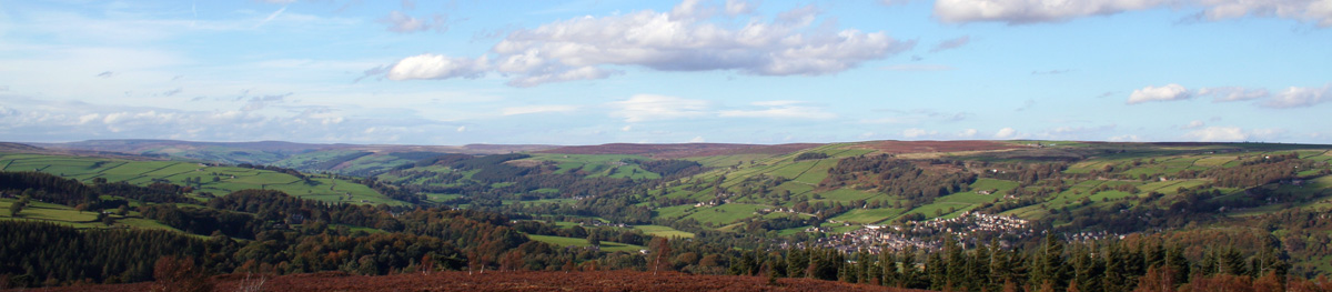
In the Yorkshire Dales lies the Nidderdale Way, a 53-mile (85 km) circular walk through wild moorland, wooded valleys, historic villages and the market town of Pateley Bridge.
The River Nidd ties the journey together. At one end, the upper dale feels open and remote; further east, the route passes farmland and sheltered river valleys. Walk the whole circuit or choose a stage and you are in for a visual treat.
The Nidderdale Way at a glance
53 miles / 85 km
Circular walk
Pateley Bridge
Traditionally four
Paths, tracks & moorland
Nidderdale National Landscape
Deep in the Dales
Nidderdale was protected for its contrasting scenery: heather moorland and wildlife, historical sites, wooded valleys and picturesque villages. Today it is called Nidderdale National Landscape; its legal Area of Outstanding Natural Beauty designation remains in place. It sits beside, but outside, the Yorkshire Dales National Park.
The River Nidd rises in the high fells and runs down the dale towards the Vale of York. The western reaches feel wilder, with few settlements and long views. To the east, the scene becomes more pastoral: fields, woodland, gardens and villages soften the valley.

Take it to the Bridge
The biggest town on the Nidderdale Way is Pateley Bridge, and many walkers use it as their base. Its streets climb the valley side above the River Nidd. Speciality shops, tearooms and pubs offer a welcome pause before or after a day on the trail.
There is more here than a convenient start point. Scotgate Ash Quarry above the town recalls Nidderdale’s stone-working past; its stone was used in buildings including London’s National Gallery. The Nidderdale Museum explores local life and industries, including agriculture. Around town, heritage trails, steep wooded slopes and riverside spots invite a slower look.
Walking the Nidderdale Way in stages
A traditional four-stage itinerary follows the circuit between the places below. These are planning endpoints, not turn-by-turn directions. The line of the route has changed in places, so use current mapping for each day.
STAGE 01
Pateley Bridge to Middlesmoor
Leave the market town and follow the valley towards the hillside village of Middlesmoor. Upper Nidderdale opens out as the route gains height.
STAGE 02
Middlesmoor to Bewerley
The upper dale and the landscape around Scar House bring a more remote character before the route returns towards Bewerley.
STAGE 03
Bewerley to Ripley
Travel through changing farmland and woodland towards the lower valley, finishing in the village of Ripley.
STAGE 04
Ripley to Pateley Bridge
Complete the circuit as the countryside rises again towards Pateley Bridge, with further views across the dale.
For detailed directions and route changes, consult the North Yorkshire Council route overview and carry current detailed mapping.
Places and stories along the way
The circuit passes through upper, middle and lower Nidderdale. Its changing scenery is part of the pleasure, but the places around it tell the story of people who have lived and worked here, too.
Upper Nidderdale: gorge, village and reservoir
Near the upper route, How Stean Gorge cuts through limestone, while cobbled Middlesmoor sits high on the valley side. Take time to look back across the dale from the village. Further into the hills, Scar House Reservoir is a reminder of Nidderdale’s industrial story. A temporary village housed workers and families during its construction; traces of that settlement remain in the landscape.
Middle Nidderdale: moor and stone
Heather moorland and woodland lend the middle valley a different character. The fantastically shaped rocks at Brimham Rocks make a memorable place to explore. Check its access information and your chosen stage before planning a detour; the rocks and surrounding moor deserve time in their own right.
Lower Nidderdale: Ripley
At Ripley, the circuit reaches a gentler, more cultivated landscape. Ripley Castle has been home to the Ingilby family for more than 700 years, and its gardens offer a change of pace after the moors. Leave time to explore the village as well as the castle grounds.
The great outdoors
For walkers, the Nidderdale Way offers a satisfying multi-day challenge. Much of the circuit uses lower paths, yet there are steep valley sides, exposed moorland and muddy stretches. The reward is the variety: one day may bring broad fellside views, another a quiet riverside path or a village street.
Cyclists and horse riders can enjoy Nidderdale on suitable rights of way, but should check dedicated routes and access permissions. The whole Nidderdale Way is a walking route, so do not assume every section is open to bikes or horses.

Plan your walk and your stay
Carry a current detailed map and check the weather before exposed sections. Wear footwear suited to uneven or muddy paths, follow waymarks, keep dogs under control around livestock and leave gates as you find them. Follow the Countryside Code when crossing working farmland.
Map and route updates
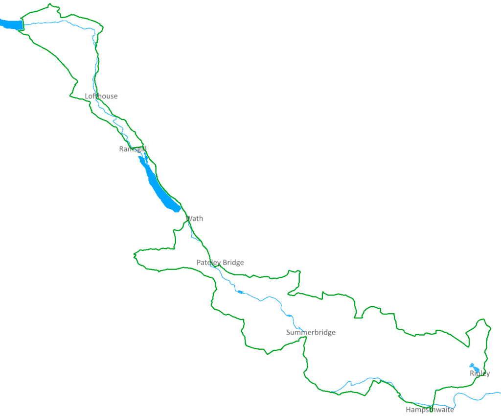
Illustration only: this simplified map shows the circuit’s general shape. Do not use it as a route guide or for navigation. Check current detailed mapping and local route changes before each stage.
Prefer a paper map? OS Explorer 298: Nidderdale, Fountains Abbey, Ripon & Pateley Bridge covers the Pateley Bridge and Nidderdale area. Check coverage for your chosen stages and use current route updates alongside any printed map.
Getting there and back
If you walk a single stage, arrange your return journey in advance. Travelling without a car? Check the current route 24 bus timetable from Harrogate. Drivers can check North Yorkshire Council’s car park directory before setting off.
Make Pateley Bridge your base
A longer stay leaves room for the town and for quieter corners of the dale. Find places to stay, places to eat and other things to do around Pateley Bridge.
From the remote upper valley to the welcome bustle of Pateley Bridge, the Nidderdale Way reveals a different side of the dale with every stage. Give yourself time to notice the landscape and the stories within it.
As an Amazon Associate we earn from qualifying purchases to fund the site.